Roadwise States Iowa Driving lessons Sign colors, shapes, and guide signs Iowa driving lesson · Signs, Signals & Markings
Sign colors, shapes, and guide signs A 3-minute lesson from the Iowa course. Read the rules and examples, follow the handbook page references, and check your understanding before you move on.
Read time 3 minutes
Course unit Signs, Signals & Markings
Checkpoint questions 6
Source pages 6, 7, 11 A sign's color and shape tell you what kind of message it carries before you can read a word. Learn both codes and you can react from far away—even when snow or dirt covers the lettering.
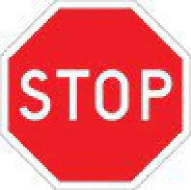
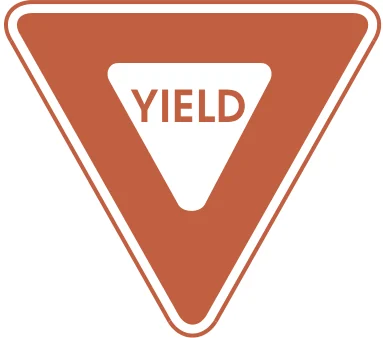
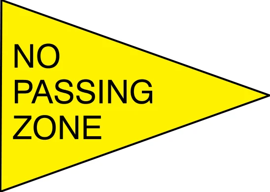
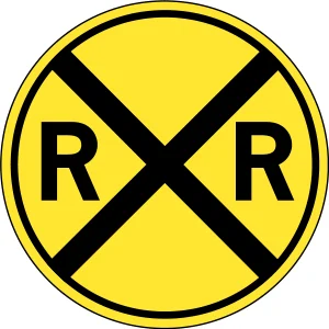
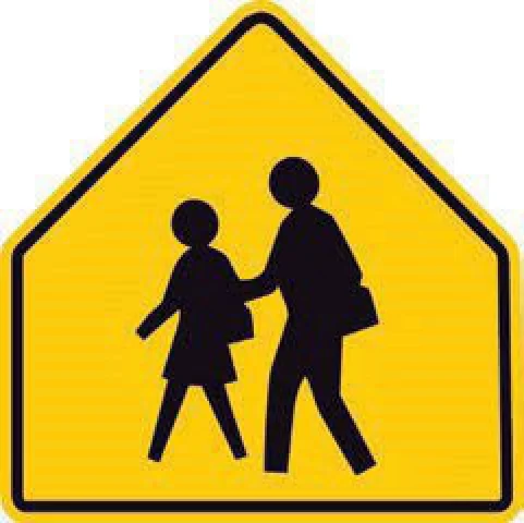
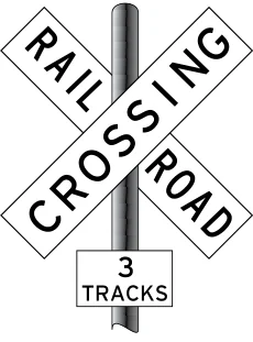
Sign colors and what they mean: Red: stop, yield, or do what is shown on the sign Green: direction—where a place is, or how far it is from you Blue: services for travelers (rest areas, hospitals, lodging, fuel, restaurants, tourist sites) Yellow: general warning Yellow-green: pedestrian, bicycle, and school warning signs White: regulatory—enforceable laws and ordinances Orange: road work, temporary traffic control, maintenance—watch for changing speed limits and workers Brown: recreation and cultural points of interest (historical sites, parks, recreational areas) Fluorescent pink: incident management, such as crash clean-up and debris removal Handbook p. 6 ↗ Sign shapes and what they mean: Octagon: reserved for the stop sign only—come to a full stop Equilateral triangle: yield the right-of-way Rectangle: used for regulatory, guide, and warning signs Pennant: on the left side of the road; warns of a no passing zone Diamond: warning of special road hazards—slow down or use extra caution Circle: railroad crossing ahead Pentagon: school crossing; marks school areas and school crossings Crossbuck: railroad crossing; placed at each crossing Handbook p. 7 ↗ Octagon: used only for STOP Equilateral triangle: YIELD Pennant: no passing zone, posted on the left side of the road Circle: railroad crossing ahead Pentagon: school crossing Crossbuck with a number sign: 3 sets of tracks to cross Know the rule
A number sign under the crossbuck shows how many sets of train tracks you must cross.
Handbook p. 7 ↗ Guide signs Show directions and distances to places such as cities, airports, and state lines, or to places of interest like national parks, historical areas, or museums.
Handbook p. 11 ↗ Mile markers Show the number of miles from where the Interstate route entered the state. Use them to figure the distance to your exit and to give your exact location in an emergency.
Handbook p. 11 ↗ Service signs Show where services are located, such as rest areas, fuel stations, campgrounds, or hospitals.
Handbook p. 11 ↗ Know the rule
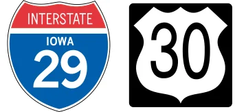
A route sign's shape tells you the type of road—interstate, U.S. highway, Iowa route, county road, etc. Follow the signs to stay on your route.
Handbook p. 11 ↗ Route signs: Interstate (shield) and U.S. highway A useful reminder Pennant = passing (no passing zone), and it's the one sign on the LEFT side of the road. Pentagon = pupils (school crossing).
Check your understanding Read the question, decide on an answer, then open it to check the explanation. These are Roadwise study questions based on the source handbook.
What does an orange traffic sign generally indicate? A regulatory law you must obey Road work A service such as a rest area A recreational or historic site Answer: Road work
Orange marks road work, temporary traffic control, and maintenance warnings.
Handbook p. 6 ↗ Which shape is reserved exclusively for a stop sign? Equilateral triangle Pentagon Octagon Diamond Answer: Octagon
The octagon shape is reserved only for a stop sign.
Handbook p. 7 ↗ You see a yellow-green sign ahead. What is it most likely warning you about? An upcoming rest area A recreational park entrance A railroad crossing Pedestrians, bicycles, or school zones Answer: Pedestrians, bicycles, or school zones
Yellow-green signs are used for pedestrian, bicycle, and school warning signs.
Handbook p. 6 ↗ What does a blue traffic sign typically indicate? A regulatory law you must follow A general road hazard warning Services like rest areas A recreational or historic site Answer: Services like rest areas
Blue signs direct you to services for travelers such as rest areas, hospitals, and fuel stations.
Handbook p. 6 ↗ A crossbuck sign at a railroad crossing includes a number sign underneath. What does that number tell you? The speed limit through the crossing How many train tracks to cross The distance to the next crossing The railroad's emergency phone number Answer: How many train tracks to cross
A number sign under the crossbuck shows how many sets of train tracks you must cross.
Handbook p. 7 ↗ A round (circle-shaped) sign warns of a school crossing ahead. True False Answer: False
False. In Iowa's sign shapes, a circle means a railroad crossing ahead; the pentagon (five-sided) shape marks school areas and school crossings.
Handbook p. 7 ↗ Previous lesson What to carry and how you get licensed Next lesson Regulatory signs More in Signs, Signals & Markings About the source Roadwise’s Iowa course uses the driver handbook edition supplied with this study pack. This lesson cites source pages 6, 7, 11. The linked PDF is a third-party mirror of the handbook, rather than a government-hosted page.
Open the handbook source PDF · View the source edition
For current application requirements, fees, appointments, and the format that applies to your age or license type, check Iowa’s DOT. Roadwise provides study material and does not issue permits or licenses.