roadwise.Open study app

Colorado driving lesson · Traffic Signals, Signs & Markings

Warning, guide & service signs

A 3-minute lesson from the Colorado course. Read the rules and examples, follow the handbook page references, and check your understanding before you move on.

Read time
3 minutes
Course unit
Traffic Signals, Signs & Markings
Checkpoint questions
6
Source pages
11, 12

Colors do a lot of the work: yellow warns, orange means a work zone, green guides, blue points to services and brown to recreation. Learn the color and you'll know the sign's purpose at a glance.

Know the rule

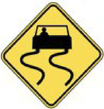
Warning signs are yellow or fluorescent green with black symbols. They warn of school zones, curves, slippery surfaces, merging traffic or pedestrian-dense areas.

Handbook p. 11 ↗
Slippery when wet
Slippery when wet warning sign

Know the rule

A merging traffic sign warns of vehicles entering from a side street.

Handbook p. 11 ↗

Know the rule

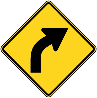
Advisory speed signs show the safe speed around curves, corners and off-ramps in ideal conditions.

Handbook p. 11 ↗
Curve right
Curve warning with advisory speed

Sign colors

Sign colors
BackgroundSign type
Orange, black letters/symbolsWork zone
GreenGuide: directions and mileage
BlueService facilities
BrownRecreational, historic or cultural areas
Handbook p. 11 ↗

Know the rule

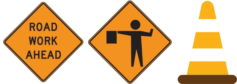
Work zone signs are used with other traffic control devices or flag persons to guide traffic through work areas and protect roadway workers.

Handbook p. 11 ↗
Road work ahead / flagger (composite)
Work zone signs

Know the rule

Railroad crossing signs come in a variety of shapes. Never try to beat a train, never start across until there's room to clear the tracks, and don't shift gears on the tracks.

Handbook p. 11 ↗

Know the rule

Blue Emergency Notification System (ENS) signs are at every highway-rail grade crossing. They give a phone number to report problems, and a DOT number below it that identifies the exact crossing.

Handbook p. 11 ↗

Know the rule

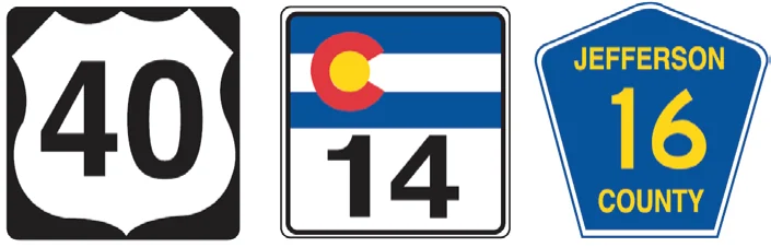
Route signs and markers: the shape of the sign indicates the type of roadway: Interstate, U.S., State or County highway.

Handbook p. 12 ↗
Route markers (composite)
U.S., state and county route markers

Put it into practice

Driving I-70, you see a brown sign with a snowflake symbol. Brown means a recreational area (like a ski area). A blue sign with gas and food symbols would point to services instead.

Check your understanding

Read the question, decide on an answer, then open it to check the explanation. These are Roadwise study questions based on the source handbook.

What color background do work zone signs use?
  1. Blue with white letters
  2. Orange with black symbols
  3. Yellow with black symbols
  4. Green with white letters

Answer: Orange with black symbols

Work zone signs have an orange background with black letters or symbols.
Handbook p. 11 ↗
What is the purpose of the blue Emergency Notification System (ENS) sign at railroad crossings?
  1. It shows the train's scheduled arrival time
  2. It marks a disabled parking space
  3. It provides a phone number to report problems or emergencies at the crossing
  4. It indicates a reduced speed zone

Answer: It provides a phone number to report problems or emergencies at the crossing

The blue ENS sign gives a phone number, and the crossing identification number, so problems can be reported to the railroad dispatcher.

Handbook p. 11 ↗
Guide signs, which give directional and mileage information, use what background color?
  1. Brown
  2. Blue
  3. Green
  4. Orange

Answer: Green

Guide signs have a green background and provide directional and mileage information to destinations.

Handbook p. 11 ↗
Signs with a brown background typically indicate what?
  1. Regulatory speed limits
  2. Service facilities like gas or food
  3. Recreational or cultural sites
  4. Work zones

Answer: Recreational or cultural sites

Brown-background signs indicate recreational, historic, or cultural areas, while blue signs point to service facilities.

Handbook p. 11 ↗
What do advisory speed signs show?
  1. The speed limit during construction
  2. The minimum legal speed on that road
  3. The maximum speed enforced by radar
  4. The safe speed for curves and ramps in ideal conditions

Answer: The safe speed for curves and ramps in ideal conditions

Advisory speed signs are cautionary signs showing the safe speed for curves, corners, and off-ramps under ideal conditions.

Handbook p. 11 ↗
What does the shape of a route sign or marker typically indicate?
  1. The number of lanes ahead
  2. The distance to the next town
  3. The type of roadway
  4. The posted speed limit

Answer: The type of roadway

The shape of a route sign or marker indicates the type of roadway, such as Interstate, U.S., State, or County highway.

Handbook p. 12 ↗
Take the lesson checkpoint in the app

More in Traffic Signals, Signs & Markings